![]()
Legacy of the Incas
Machu Picchu Luxury Tours
Peru:
Machu Picchu - Lake Titicaca
(11 days/10 nights)
Machu Picchu Luxury Tours
Peru:
Machu Picchu - Lake Titicaca
(12 days/11 nights)
Empire of the Sun
Machu Picchu Luxury Tours
Peru:
Machu Picchu - Lake Titicaca
(14 days/13 nights)
Ancient Civilizations of Peru
Machu Picchu Luxury Tours
Peru:
Colca Canyon - Machu Picchu
Lake Titicaca
(16 days/15 nights)
Archaeological & Ecological
Treasures
Machu Picchu Luxury Tours
Peru & Ecuador:
Galapagos - Machu Picchu
Lake Titicaca (or Amazon)
(18 days/17 nights)
Grand Tour of the Inca Empire
Machu Picchu Luxury Tours
Peru:
Colca Canyon - Amazon
Machu Picchu- Lake Titicaca
(22 days/21 nights)
Ancient & Colonial Capitals
Machu Picchu Luxury Tours
Peru:
Machu Picchu
(10 days/9 nights)
Inca Trail to Machu Picchu
Machu Picchu Luxury Tours
Peru:
Machu Picchu
(13 days/12 nights)
Machu Picchu & Galapagos
Machu Picchu Luxury Tours
Peru & Ecuador:
Machu Picchu - Galapagos
(15 days/14 nights)
Galapagos & Machu Picchus
Machu Picchu Luxury Tours
Ecuador & Peru:
Galapagos - Machu Picchu
(18 days/17 nights)
Enchanted Isles of the Galapagos
Machu Picchu Luxury Tours
Ecuador:
Galapagos
(11 days/10 nights)
Galapagos & the Kingdom of Quito
Machu Picchu Luxury Tours
Ecuador:
Galapagos - Andes
(16 days/15 nights)
Galapagos & the Amazon
Machu Picchu Luxury Tours
Ecuador:
Galapagos - Amazon
(16 days/15 nights)
Historic Haciendas of the Andes
Machu Picchu Luxury Tours
Ecuador:
Cotopaxi - Antisana - Otavalo
(7 days/6 nights)
© 2013 Inka's Empire Corporation.
All rights reserved.
![]()
Cuzco to Machu Picchu Route
Machu Picchu Luxury Tours & Travel
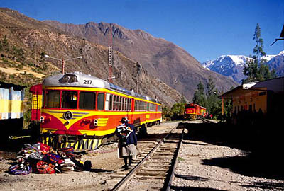
Vistadome from Machu Picchu to Cuzco.
Photo: Mylene d'Auriol Stoessel. Machu Picchu Luxury Tours & Travel.
"... Great snow peaks looming above the clouds more than two miles overhead; gigantic precipices of many-colored granite rising sheer for thousands of feet above the foaming, glistening, roaring rapids, it has also, in striking contrast, orchids and tree ferns, the delectable beauty of luxurious vegetation, and the mysterious witchery of the jungle. One is drawn irresistibly onward by ever-recurring surprises through a deep, winding gorge, turning and twisting past overhanging cliffs of incredible height."
-- Hiram Bingham, Lost City of the Incas, 1948
This magnificent line, widely considered to be one of the world's great train journeys, was built at the beginning of the twentieth century to link the highlands of Cusco with the Lower Urubamba Valley and the Amazon Basin beyond.
After leaving San Pedro station, the train climbs quickly out of the imperial city along a series of zig-zagging switchbacks, which carry it through a chaos of alternately muddy and dusty streets between houses, which seem to cling precariously to the hills surrounding Cusco's historic centre.
The train emerges from this suburban sprawl at El Arco, where a stone aqueduct once leap-frogged the railway line and is met by the magnificent sight of undulating green uplands unfolding towards the horizon, where they meet on a clear day with the snow capped Vilcabamba mountains to the northwest.
After passing the small town of Poroy and going through Cachimayo, the train continues its sinuous descent to the plateau of Anta, a patchwork landscape of typical Andean crops such as quinoa, corn, potatoes and beans. The Pampa de Anta is reputed to have been the battleground upon which the armies of the great warrior-statesman Pachacutec repelled the invading Chanca tribe, thereby launching the Incas on their golden age of imperial expansion.
Far to the left, just below the horizon, the massive agricultural terraces of Jaquijahuana can be seen, close to the village of Zurite. Sadly, these great terraces are all that remain today of what was once a major Inca city, lost forever during the first years after the Spanish conquest. Remarkably, their fertile soils were transported from the village of Yucay in the Sacred Valley, a place as renowned today as it was during Inca times for its production of the finest quality corn.
Beyond the town of Huarocondo the great plain narrows dramatically as the track enters a deep gorge carved by the rushing Pomatales River down which the railway, too, is funnelled until it meets the Urubamba River at Pachar.
The train now passes through extensive areas of terracing dotted with the ruins of Inca fortresses. Bisecting this are still-visible sections of an ancient, long-abandoned highway adopted by the muleteers of the late 19th century, who used it to travel between Cusco and the rubber plantations of the Amazon lowlands.
Some five kilometres beyond Pachar, is the village of Ollantaytambo. Here farmers, under the paternal gaze of the sacred peaks of Wakay Willka (or, "The Tears of God") and Alankoma, whose melt waters irrigate their land, work with the same patience and skill that their ancestors must have employed to shape and then move the huge blocks of stone with which they built both their homes and the temples in which they worshipped.
As the train leaves the station at Ollantaytambo to begin the last part of its journey to Machu Picchu, the temple complex known as The Fortress, dedicated sometime in the 15th century to the many deities of the Inca pantheon, can be seen to the right above the earthwork ramp once used to drag its monolithic blocks up from the valley floor.
The railway now follows the river into the Urubamba Gorge, as it tumbles helter-skelter between the high walls of teeming vegetation that mark the beginning of the cloud forest beyond Chillca (Km. 82). At Coriwaynachina, known simply to the generations of hikers who have begun the Inca Trail there as Km. 88, a fine staircase carved into the rock leads to a series of ruined buildings where once, it is said, Inca artisans took advantage of the constant wind that rises from the valley floor to smelt gold.
Emerging from a short tunnel, a series of beautiful agricultural terraces marks the ruins of Qente, which in Quechua means hummingbird. In this fertile microclimate fed by a nearby waterfall, giant hummingbirds are indeed a common sight in the early morning and bright flowers bloom all year round.
Surrounded by tall ceibos and rocky outcrops hung with orchids and bromeliads, the train passes Km. 104 at Chachabamba, from where the one-day trek to Machu Picchu via the magnificent ruins of Wiñay Wayna begins.
Another three kilometres along the track the Inca grain silos, or colcas, of Choquesuysuy may be glimpsed above the river on the opposite bank to the hydroelectric dam, whose generating plant some ten kilometres beyond Machu Picchu, was destroyed in 1998 by the same enormous landslide that swept away great swathes of the 79 kilometre-long railway line that once ran to the coffee-growing jungle town of Quillabamba.
At Km. 110, just two kilometres from Machu Picchu, the train arrives at Aguas Calientes. Surrounded by the high, green mountains that cradle the famous lost city as well as myriad other Inca remains, this small town, which is well-known for its thermal baths, has blossomed into a popular overnight destination for travellers to Machu Picchu, for whom it offers a wide range of reasonably-priced places both to eat and to stay.
Source: PeruRail
© 2013 Inka's Empire Corporation, Machu Picchu Luxury Tours. All rights reserved.
